A Local’s Guide to the Best Hiking Near Nashville
Tennessee as a whole features an impressive display of topography, with the Great Smoky Mountains to the east, the Ocoee River to the south, and the Mississippi River to the west—but sometimes, it seems like Middle Tennessee gets overlooked when it comes to outdoor adventure. However, locals know there are many opportunities to enjoy the great outdoors in and around Nashville, and in particular, there’s a lot of hiking near Nashville if you know where to look.
If you have a job with a flexible schedule and the ability to do a day hike near Nashville during the week, you’ll likely have the trails to yourself—or at least less congestion in the parking lots. The waterfall trails in particular are a popular outdoor spot on summer weekends among crowds looking to cool off. But never fear! Even if your lifestyle doesn’t allow for weekday getaways, there’s still a hike near Nashville that’s right for you.
Check out these nine options within a two-hour drive of Nashville. This list starts with those that are in the city and then heads farther afield to state parks and other destinations that require a little bit of a drive (trust us—they’re worth it.)
1. Beaman Park (Nashville, TN)
Distance from Downtown Nashville: 13 miles
How long is the hike? 15 miles
Why go? Beaman Park is one of the standouts of Nashville’s impressive Greenways system, which offers a network of more than 100 parks and green spaces across the entire city centered around eight major water corridors. This 2,371-acre park on the northwest side of town features shaded areas with waterfalls, wildflowers, elevation changes, and a network of intersecting trails, including loops and out-and-backs.
You can opt for the 2.2-mile Henry Hollow Loop trail, which can be accessed from three different trailheads and parking lots at Beaman Park. Or, you can connect to the Ridgetop Trail for a total of five miles.
Insider tip: Beaman is a must-do destination during Nashville’s hot summers because so much of the trail has ample shade.
2. Shelby Bottoms (Nashville, TN)
Distance from Downtown Nashville: 4 miles
How long is the hike? 9.7 miles paved, 6.6 miles unpaved
Why go? This large Greenway is one of the city’s most popular, in part because it connects East Nashville to downtown. Its trails wind through open meadows popular among birders, past small ponds and waterfowl habitats, and through the Cornelia Fort Airpark, a former small airport that is now a space to ride bikes, fly kites, and even watch concerts.
Insider tip: Shelby Bottom’s Cumberland Pedestrian Bridge spans the Cumberland River and connects to the Donelson and the Opryland area, including Two Rivers Park. It provides a great overlook of the city’s main waterway. The General Jackson riverboat passes under it most days and makes for a great photo op!
3. Whites Creek at Fontanel (Nashville, TN)
Distance from Downtown Nashville: 11 miles
How long is the hike? 1.5 miles of paved trails, 1.8 miles of unpaved trails
Why go? This lesser-known section of the Greenway offers something for everyone. The paved trails are relatively flat, meaning they are wheelchair- and stroller-accessible. This walking trail offers gorgeous views of the hillside and meadows, along with the Fontanel development.
The narrower unpaved trails are particularly dog-friendly—there are bone-shaped benches perfect for a rest stop, along with signage with tips about how to keep your dog healthy and happy. Do note that the trails here have some rolling elevation changes. If you’re hiking in warmer weather, you’ll be pleased to know that the unpaved trails have lots of shade for hot days.
Insider tip: This area was once the estate of country music star Barbara Mandrell. It is not currently open for tours, but you can glimpse her old house—which at the time was the largest log cabin in the world. You can also fly past it if you zipline here with Adventureworks Nashville.
Tips From a Landing Member

“I recommend taking your dog with you on your adventure, since the trails aren’t too steep. If you don’t have a dog, you can always borrow one! The Nashville Humane Society allows visitors to take a dog out for a few hours on a ‘Doggie Date’ so they can get some fresh air and fun time with a human. It’s a great way to give back to the community, and it guarantees you’ll have the perfect hiking buddy for your outdoor activities!”
— Jess Goudreault, “The Top 6 Outdoor Activities in Nashville”
4. Warner Parks (Nashville, TN)
Distance from Downtown Nashville: 11 miles
How long is the hike? 12 miles of unpaved trails, 12 of paved trails
Why go? Combined, Edwin Warner Park and Percy Warner Park are Nashville’s largest parks. They are home to an equestrian center, a model airplane field, and a hiking trail system that started with Works Progress Administration in the 1930s. The Harpeth Woods Trail is a good 2.5-mile option for an easy outing.
Insider tip: Trails are color-coded and maps are available at the visitors center.
5. Long Hunter State Park (Nashville, TN)
Distance from Downtown Nashville: 23 miles
How long is the hike? 25 miles
Why go? This former farmland along Percy Priest Lake offers many different hiking trails for different ability levels. Looking for something quick and easy? Opt for the mile-long Deer Trail, which winds its way through woodland starting at the park office. The longest hike at the park is the moderate Volunteer Trail, which is 5.5 miles one-way and is particularly pretty in spring when wildflowers are in bloom.
Insider tip: Long Hunter’s location on the shores of Percy Priest Lake make it popular among boaters, too. There are two boat ramps and boats available for rent.
6. Radnor Lake State Natural Area (Oak Hill, TN)
Distance from Downtown Nashville: 10 miles
How long is the hike? 6 miles
Why go? This lake was created to provide water for steam engines during the railroad heyday. Dogs are not permitted on most of the trails, and paddling and boating are prohibited on the lake. That means that the wildlife is the focus. You’ll see all sorts of waterfowl and other native animals. There are overlooks where you can stop and take it all in. Parts of the paved trails and wheelchair- and stroller-accessible.
Insider tip: Radnor is one of the parks in the Tennessee State Park system that has viewfinders with special Enchroma lenses that help people with colorblindness see the majesty of the greens, blues, reds, and golds of this landscape. Look for it near the Otter Creek overlook.
7. Fiery Gizzard Trail
Distance from Downtown Nashville: 97 miles
How long is the hike? 12.5 miles
Why go? This challenging, popular hike within South Cumberland State Park takes hikers past waterfalls and impressive overlooks of the Cumberland Plateau. Most people who hike the Fiery Gizzard Trail have a car on each end rather than doing it as an out-and-back hike (which would make it 25 miles). There are shorter hikes, including the three-mile Sycamore Falls Loop, which features the opportunity to cool off in a swimming hole (bring your bathing suit!).
Insider tip: South Cumberland State Park spans four different Tennessee counties and includes many other hiking options, including Greeter Falls and Savage Gulf.
8. Burgess Falls State Park (Sparta, TN)
Distance from Downtown Nashville: 80 miles
How long is the hike? 1.5 miles
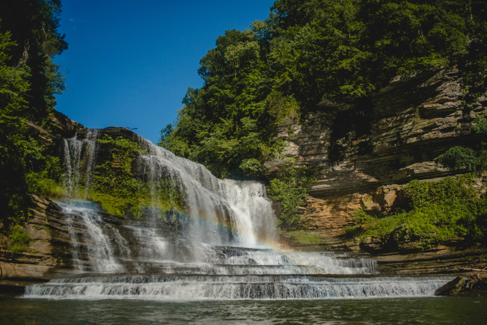
Why go? Don’t let the length of this hike fool you: Burgess Falls State Natural Area is a strenuous hike that requires steady footwork. It is steep and can be slippery. The payoff is seeing four different waterfalls, the highest of which is 136 feet high. There’s also a one-mile ridge-top trail that affords some awe-inspiring views. This is a more moderate hike, as it is the portion of the trail near the lower falls that is the most strenuous.
Insider tip: Most people take the steep way down to see the falls and then hike out along the service road, which doesn’t have the views, but is more sure-footed.
9. Fall Creek Falls State Park (Spencer, TN)
Distance from Downtown Nashville: 124 miles
How long is the hike? Ranges from 0.5 miles to 14 miles
Why go? This state park offers a number of different hikes from quick, easy options to longer overnight treks. The Gorge Overlook Trail is a 1.2-mile option that is a relatively moderate climb that offers views of the 256-foot falls, which are one of the tallest in the eastern half of the United States.
Insider tip: The Lodge at Fall Creek Falls has a restaurant with lake views and it is a lovely place to reward yourself after a hike.
No matter what kind of hiker you are, you’ll find something that suits your needs near Nashville. Thinking about heading to town to try them out? Check out Landing’s fully furnished apartments in Nashville, each with flexible leases that let you live life on your terms. Learn more about what a Landing membership can do for you today!
Looking for more hiking inspiration? Check out our blog post, “The 15 Best Hiking Trails in the U.S. to Check Off Your Bucket List.”


