Account
  Reservations
  Support
The 15 Best Hikes Near Portland, Oregon
Around Portland, you’re never far from your next favorite hike. Within city limits, for instance, hikers of all skill levels and abilities can head through forests of Douglas fir to sweeping viewpoints. And, if you’re up for a quick drive, epic trails in the Columbia River Gorge, on Mount Hood, and throughout the Willamette Valley lead to thundering waterfalls, colorful wildflowers, and wide-open vistas.
If you’re excited to hit the trail, we’ve rounded up 15 of the best hikes around Portland, Oregon, including:
- Lower Macleay Park to Pittock Mansion
- Mt. Tabor Park
- Tryon Creek State Natural Area
- Powell Butte
- Marquam Trail to Council Crest
- Latourell Falls Loop
- Multnomah-Wahkeena Falls Loop
- Angel’s Rest
- Dry Creek Falls
- Dog Mountain
- Tamanawas Falls
- Ramona Falls
- Elk Meadows
- Tom Dick and Harry Mountain
- Trail of Ten Falls Loop
Let’s get started!
1. Lower Macleay Trail to Pittock Mansion

Sitting within city limits, the Lower Macleay Trail to Pittock Mansion is among the most popular hikes anywhere around Portland. Hikers gently ascend through a moss-covered canyon in Forest Park, pass a stone structure that dates back to the 1930s (known affectionally around town as “The Witch’s Castle”), catch part of the 30-mile Wildwood Trail, and end at the foot of Pittock Mansion, where sweeping views of the Portland city skyline await.
In spring, watch for three-petal, white trillium blooms among the ferns lining the trail and take a minute to appreciate the colorful rose bushes on the Pittock Mansion grounds. The surrounding area is free to explore, though the mansion itself is open for a fee.
In all, the roughly six-mile hike gains just over 1,000 feet and takes about three hours to complete, though those pressed for time (or hikers in search of a dog-friendly trek) often turn around at The Witch’s Castle, turning the outing into a quick, one-mile round-trip hike.
2. Mt. Tabor Park

If you’re looking to stretch your legs between meetings, you could do a lot worse than Mt. Tabor Park, where hikers can ascend an extinct volcano and enjoy views of both Mount Hood and the Portland skyline—all without leaving the city.
In all, the two-mile hike boasts about 350 feet of elevation gain while passing historic reservoirs (which once held Portland’s drinking water), a bevy of big-leaf maple trees (which turn brilliant shades of red, orange, and yellow every autumn), and reddish cinder rock—a clear reminder that you’re hiking inside a volcano. Give yourself one to two hours to do the whole hike, which boasts numerous views that encourage lingering.
The short distance and relatively gentle elevation gain make the Mt. Tabor Park trail popular with families and hikers with dogs.
3. Tryon Creek State Natural Area

No matter the time of year, you’ll find something to love about the many hikes through Tryon Creek State Natural Area—the only state park within a metropolitan area in Oregon. Just a 15-minute drive from downtown Portland, Tryon Creek hosts eight miles of gently rolling hiking trails, which makes it easy to choose a few footpaths to fit your skill level and time constraints.
In fall, bigleaf maple trees dazzle with colorful foliage while salmon can be spotted in the creeks that run through the park. In winter, the quiet forest offers a welcome dose of solitude within the city. In spring, trillium, tiger lily, fireweed, and other wildflowers bloom throughout the park. And in summer, the towering Douglas fir trees provide plenty of shade to keep hikers cool.
Barrier-free trails accommodate hikers in wheelchairs, while families appreciate the loops of varying sizes and gentle elevation gains.
4. Powell Butte Nature Park

Have you ever hiked around a 10-million-year-old volcano? You can do just that on the Powell Butte Loop Hike, a 4.5-mile trek that gains about 530 feet and heads through several scenic settings within Portland city limits. Give yourself about two to two and a half hours to complete the whole hike.
We may be recommending a certain loop, but a network of trails makes it easy to pick and choose your desired hike length. Whatever you choose, you’ll find plenty to love about Powell Butte. Wildlife is abundant (including several species of raptor), the forest is lush (featuring Douglas fir, western hemlock, and western red cedar), and views include Mount St. Helens, Mount Hood, and even the tip of Mount Jefferson to the south.
Similar to Tryon Creek, the ability to choose your trails and create your own loop makes this one of the best hikes in Portland for families.
5. Marquam Trail to Council Crest

Sitting just south of downtown Portland, the Marquam Trail to Council Crest hike winds through a forest of Douglas fir in the heart of the city (and past several homes) before arriving at the highest point within city limits.
In all, the four-mile hike gains about 650 feet and takes two to 2.5 hours to complete—perhaps a bit more if you decide to linger on the grassy park atop Council Crest, where views of five peaks await on clear days (including Mount Hood, Mount Jefferson, and Mount Rainier in Washington). Keep an eye out along the way for sword ferns, Oregon grape (the official state flower), and even owls perched on branches in the lush forest surrounding you.
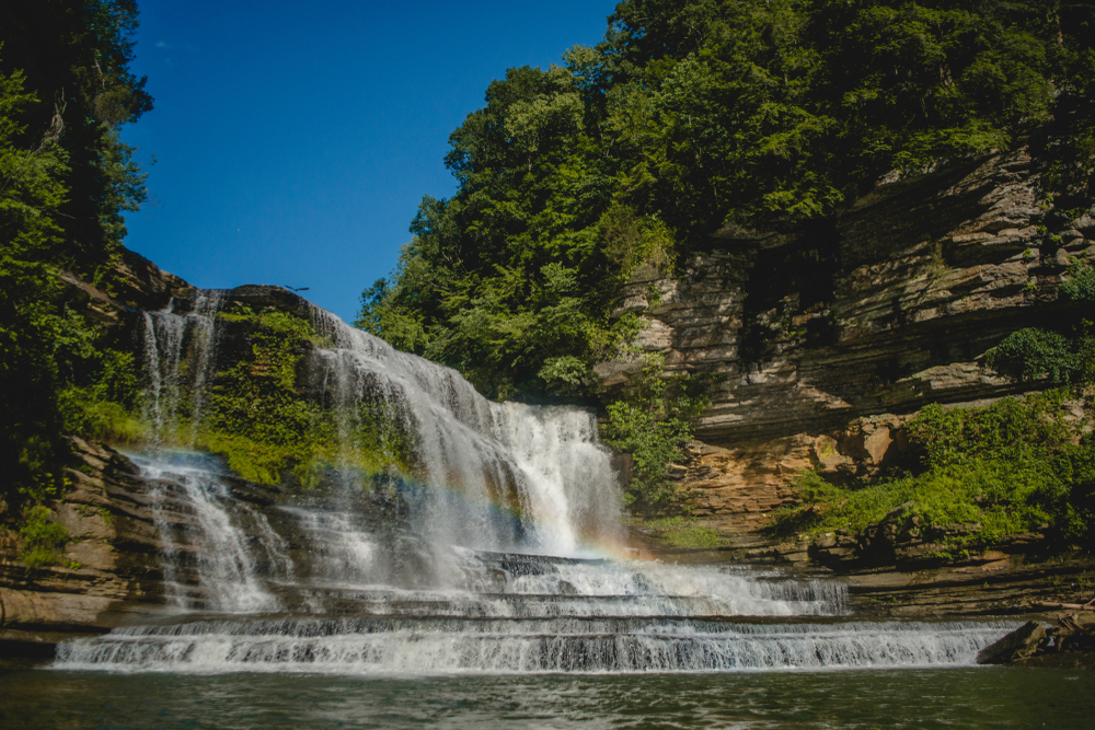
6. Latourell Falls Loop

You can see the eponymous highlight of the Latourell Falls Loop just a two-minute walk from the trailhead (which sits about 35 minutes east of Portland). But doing the three-mile loop hike rewards hikers with views of a second waterfall, lush forests, and views of the surrounding gorge.
The Latourell Falls Loop can get packed on sunny summer weekends, so to avoid the crowds, we recommend getting an early start on weekdays if your schedule allows. The trail quickly ascends to a viewpoint of Latourell Falls, surrounded by a moss-covered amphitheater of columnar basalt, before heading into a thick forest. From there, it reaches the 120-foot, two-tiered Upper Latourell Falls before slowly descending back toward the trailhead. As it returns to the parking area, the trail passes the base of Latourell Falls.
In all, the hike has about 900 feet of elevation gain, with most of that coming soon after the parking lot. Give yourself up to two hours to do the whole loop.
Keep in mind that, between mid-May and Labor Day weekend, you may need a timed-use permit to access the Historic Columbia River Highway east of Latourell Falls. Learn more about timed-use permits in the Columbia River Gorge, including where they may be required, when they might be necessary, and how to purchase one.
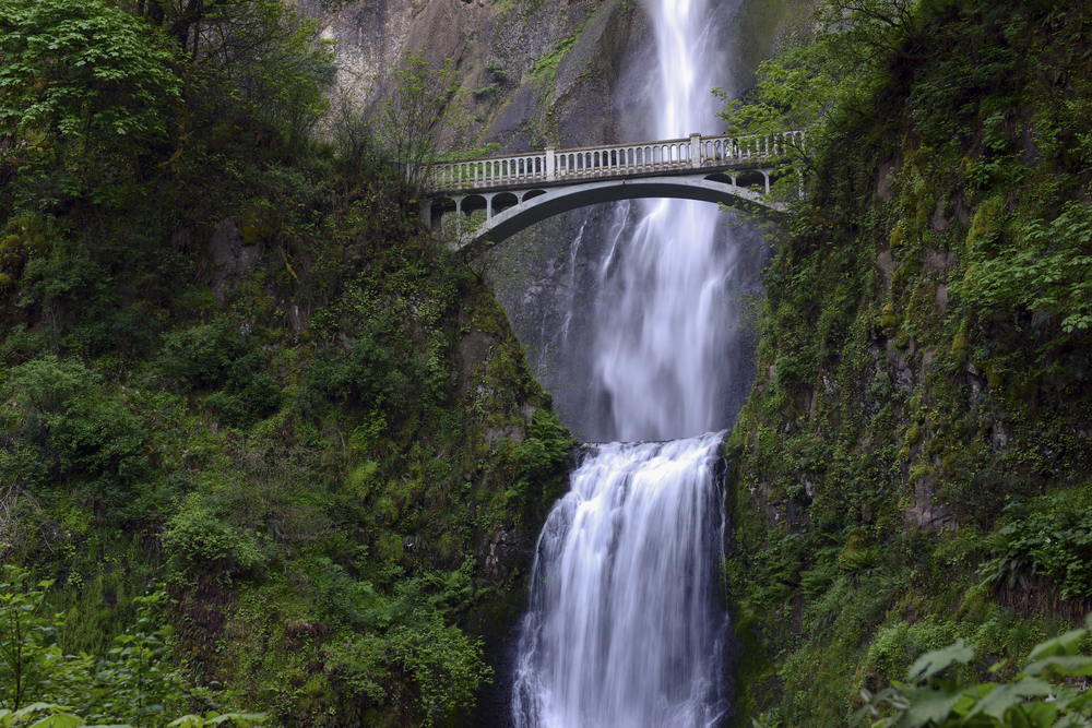
7. Multnomah-Wahkeena Falls Loop

According to the Sierra Club, the Columbia River Gorge is home to the highest concentration of waterfalls in North America—more than 90, in all—and the Multnomah-Wahkeena Falls Loop hike is a great spot for seeing roaring cascades in the region.
The five-mile hike gains about 1,600 feet and takes about three hours to complete while passing six officially named waterfalls along the way. Of course, you can start by ascending the paths at either Multnomah Falls (among the tallest waterfalls in Oregon) or Wahkeena Falls before venturing into the heart of the Gorge, where you’ll pass the likes of Ecola Falls, Wiesendanger Falls, Fairy Falls, and more. Between April and June, watch for purple phlox, bear grass, tiger lilies, and other wildflowers along the trail—especially in sections of forest that are recovering from wildfire.
The trail is about 30 to 40 minutes east of Portland, whether along I-84 or the Historic Columbia River Highway. Note that a timed-use permit may be required to access Multnomah Falls between mid-May and Labor Day weekend. Ahead of your hike, learn more about timed-use permits in the Columbia River Gorge, including where you might need them, when they might be required, how to purchase one, and whether alternative forms of transportation (such as shuttle buses) may be available.
8. Angel’s Rest

The out-and-back Angel’s Rest trail is among the best hikes near Portland, Oregon, with sweeping views of Beacon Rock, Cape Horn, and other iconic Gorge landmarks awaiting at the summit. Along the way, you’ll pass through forests scarred by a pair of wildfires and enjoy top-down views of the 150-foot Coopey Falls.
In all, the trail measures about five miles round-trip, with a hearty 1,500 feet of elevation gain. We recommend giving yourself up to three hours to enjoy scenic summit views and complete the entire hike.
Angel’s Rest is just 30 minutes east of Portland. Friendly note: In 2022, timed-use permits were required for drivers on a perpetually busy stretch of the Historic Columbia River Highway, at least between mid-May and Labor Day weekend. If driving the highway east of Angel’s Rest during this time of year, you may be required to purchase a permit in advance. Here’s the scoop on timed-use permits in the Columbia River Gorge, including where you might need one, when they might be required, and how to buy one.
9. Dry Creek Falls

With a trailhead that begins in the heart of Cascade Locks, the trek to Dry Creek Falls is among the most popular in the Gorge—and not just because you can enjoy post-hike patio beers at nearby Thunder Island Brewing Co. or Gorges Beer Co.
It’s a 4.4-mile round-trip trek to the base of the 75-foot Dry Creek Falls, which plunges into its namesake creek in the midst of a moss-covered amphitheater of columnar basalt. You’ll gain about 725 feet while ascending through a forest still regrowing after a devastating wildfire that started nearby in 2017, with colorful wildflower displays lining the trail in spring. Give yourself two to two and a half hours to complete the whole hike.
From Portland, the drive to the Dry Creek Falls trailhead takes about 45 minutes via I-84.
10. Dog Mountain

There are few more famous (or more strenuous) hikes in the Columbia River Gorge than Dog Mountain. The loop trail to the summit of Dog Mountain measures about seven miles in all, with a difficult 2,900 feet of elevation gain—roughly 1,000 feet per mile. As such, try giving yourself at least four hours to complete the trek.
But if you do, you’ll enjoy wide-open views of the Columbia River Gorge and Mount Hood rising above it all. In spring, Dog Mountain’s upper meadows come alive with dazzling wildflower displays—bright yellow balsamroot is the most common plant—that provide a perfect backdrop for the sweeping vistas.
Keep in mind that a permit may be required to hike Dog Mountain on weekends during peak wildflower season, typically mid-April to mid-June. If planning a springtime hike, learn more about the Dog Mountain Permit System before heading out.
The drive to Dog Mountain takes about one hour via I-84 and Highway 14 in Washington. Note that you must pay a toll if crossing into Washington at the Bridge of the Gods in Cascade Locks. Tolls for passenger vehicles are $3 and can be paid with cash or a card.
11. Tamanawas Falls

The 3.5-mile round-trip hike to Tamanawas Falls follows the bubbling Cold Spring Creek while gaining about 550 feet. The ambling hike takes about two hours to complete.
It’s not the only waterfall hike in the region, but Tamanawas Falls earns plaudits for a gentle grade (making it a dog-friendly and family-friendly trek) through towering forests of Douglas fir. In summer, colorful wildflowers add a pop of color to the trail. And the scenic, 110-foot Tamanawas Falls provides a picturesque photo op as it falls over a shelf of lava rock.
From Portland, the drive to the Tamanawas Falls trailhead takes about 90 minutes via I-84 and Highway 35.
12. Ramona Falls

The Ramona Falls loop hike offers a little of everything that makes Mount Hood so special, including alpine forests, occasional views of Oregon’s tallest peak, and perhaps the most unique waterfall in all of Oregon: Ramona Falls. This waterfall fans out over a shady rock wall in a steep, stairstep-like fashion and is noted as much for its width as its height.
In all, the Ramona Falls loop hike measures about seven miles round-trip, with a gentle 1,035 feet of elevation gain and takes around four hours to complete. For most hikers, the hardest part of the trail is navigating a lone log “bridge” placed across the Sandy River every summer. Take caution while navigating the log, and do not attempt a crossing if the river is running high and/or fast (which happens most often in the late afternoon in the heart of summer).
The drive to the Ramona Falls trailhead takes just over one hour from Portland.
13. Elk Meadows

Every summer, soon after snow melts on Mount Hood, colorful wildflower displays pop up along trails and in meadows all over the mountain. And there may be no better wildflower hike than the 5.8-mile Elk Meadows hike, which offers 1,200 feet of elevation gain and takes about three hours to complete.
The trail crosses the glacier-fed Newton Creek, ascends through an old-growth forest of Douglas fir, and offers pristine views of Mount Hood’s snow-covered peak. Some of the many wildflowers you’ll encounter in July and early August include purple lupine, white-fringed grass of Parnassus, and purple aster.
From Portland, the drive to the Elk Meadows trailhead takes about one hour and 20 minutes via Highway 26 and Highway 35.
14. Tom Dick and Harry Mountain

Whether you’re looking for a quick ascent to a scenic lake or a longer trek that boasts wide-open views, the Tom Dick and Harry Mountain hike is among the most popular near Portland—and for good reason.
The trail’s first highlight is Mirror Lake, which reflects Mount Hood’s snowy peak in its crystal-clear waters and can be accessed via a short, gently graded hike through a lush forest. Most families turn around at Mirror Lake, but dedicated hikers continue onto the summit of Tom Dick and Harry Mountain, where Mount Hood and its forested slopes appear to be just across the street. The entire trail is about 7.7 miles round-trip, with just over 1,450 feet of elevation gain. It takes about four hours to complete.
From Portland, the drive to the Mirror Lake trailhead takes about one hour and 10 minutes via Highway 26.
15. Trail of Ten Falls Loop

There are few more popular hikes in the Pacific Northwest than the Trail of Ten Falls loop hike in Silver Falls State Park. Over the course of 7.8 scenic miles, the trail offers views of (you guessed it!) a whopping 10 waterfalls, with the chance to even go behind a few. The tallest of the waterfalls measures 178 feet, and five are at least 100 feet tall.
While this is known as a fun summer hike, fall brings colorful foliage displays and spring offers the most thundering flows, which are fed by snowmelt. Not just that, but crowds are far smaller the further you get from summer and the earlier you start in the day.
In all, the trail has about 1,300 feet of elevation gain, though most of that comes via rolling hillsides. Give yourself at least four hours to do the whole hike.
From Portland, the drive to Silver Falls State Park takes about one hour and 10 minutes via I-5 and OR-214 southbound.
Thinking about moving to Portland?
After a day on the trail, you’ll want a comfortable base camp to return to—and Landing can help, with fully furnished apartments in Portland. These apartments come with flexible terms and offer easy access to hiking trails both in around the city. Learn about how a Landing membership can help you make the move and enjoy all Portland has to offer—indoors and out!
Related Articles